Beobachtungen
Observations:
Archäologie
Archaeology
Archäologische Ausgrabungen sollten sinnvollerweise mit radiästhetischen Methoden begleitet werden.
Viele der Strukturen im Boden lassen sich von erfahrenen Personen durch Spüren erfassen.
Archaeological
excavations
should be accompanied by radiaesthetic methods.
Many of the structures in the ground can be perceived by experienced persons possibly.
Many of the structures in the ground can be perceived by experienced persons possibly.
/Bird 1979/ S, 175
Aleksander Pljuznikov Restaurierung russischer Baudenkmäler, Befestigungsanlagen Schlachtfeld von Borodino von 1812
Restoration of Russian architectural monuments, fortification battleground of Borodino
/Bird 1979/ S. 19
Unterirdische Hohlräume in Paris, Armand Viré Underground cavities in Paris
/Bailey 1988/ Dowsing and Church Archaeology
/van Leusen 1998/ schlechte Vorarbeit liefert schlechte Ergebnisse bad preliminary work supplies bad results
/Hillmann-Crouch 1999/ Dissertation, Test mit wenig erfahrenen Rutengängern
Dowsing Archaeological Features; An empirical study at Cressing Temple Test with little experienced dowsers
/Wilcock 1994/ Dean Caving Symposium, /Wilcock 1993/ Water Icicle Close Biolocation Exercise
Unterschiedliche Strukturen im Boden sind spürbar, beispielsweise Grabflächen friedhof
Different
structures
in the ground are perceiveably, for example grave
surfaces
Die Ausgrabung an der Pfalz bei Werla The excavation at the palatinate near Werla
http://maps.live.de/LiveSearch.LocalLive?
GPS-Daten grabung-werla-003.gdb und interaktives GoogleLuftbild archaeologie.kmz
Bei einem kurzen Test mit dem Archäologen Dr. Michael Geschwinde aus Braunschweig im Jahre 2008 konnten durch den Autor Strukturen einer früheren Grabung unter einer Wiesenfläche aufgespürt werden. (Mauern eines ehemaligen Kellers)
Im Mai 2009 wurde getestet, ob sich die Spuren eines Graben verfolgen lassen. Die Archäologen hatten den Graben an einer Stelle angeschnitten, sie kannten seine ungefähre Lage anhand von Magnetprospektionsdaten.
Ohne Kenntnis der genauen Lage dieser Prospektionsdaten, sondern nur durch Beobachtung und Wahrnehmung der Eigenschaften eines freigelegten Stückes (Abb. 10), wurden eine Sondierung nach der natürlichen Methode begonnen (25.5.09). natürlich /E
Innerhalb von etwa 11 Minuten waren die Positionen der beiden Kanten eines rund 230 Meter langen Abschnitts aufgenommen und per GPS protokolliert. Die mittlere Suchgeschwindigkeit betrug dabei 2,5 km/h.
In einem zweiten Schritt wurde (4.6.09) ein weiteres 240 Meter langes Stück des Grabens in 8 Minuten abgeschritten.
With
a short
test with the archaeologist Dr. Michael Geschwinde from
Braunschweig in the year 2008 could be sought out by the
author
structures of an earlier excavation under a meadow
surface. (Walls of a
former cellar)
In May 2009 it was tested whether the traces of a ditch can be pursued. The archaeologists had begun to cut the ditch at one location, and they knew its approximate location on the basis of magnetic exploration data.
Without knowledge of the exact information of those data, but only by observation and perception of the characteristics of an opened part of the ditch (fig. 10), an exploration according to the natural method was begun (25.5.09). natürlich /E
Within approximately 11 minutes the positions of the two edges of an approximately 230 meters long section were taken up and logged by GPS. The average search speed amounted to thereby 2.5 km/h.
In a second step (4.6.09) a further 240 meters long piece of the ditch was explored in 8 minutes.
Zum Verfahren: Beim Verfolgen einer Kante geht man von
außen
jeweils auf das Objekt zu und beim Wechsel des
gespürten Eindrucks
wieder nach außen zurück. (wie ein
Tischtennisball, der von
der Tischplatte abprallt.) kanten-detektor.htmIn May 2009 it was tested whether the traces of a ditch can be pursued. The archaeologists had begun to cut the ditch at one location, and they knew its approximate location on the basis of magnetic exploration data.
Without knowledge of the exact information of those data, but only by observation and perception of the characteristics of an opened part of the ditch (fig. 10), an exploration according to the natural method was begun (25.5.09). natürlich /E
Within approximately 11 minutes the positions of the two edges of an approximately 230 meters long section were taken up and logged by GPS. The average search speed amounted to thereby 2.5 km/h.
In a second step (4.6.09) a further 240 meters long piece of the ditch was explored in 8 minutes.
Als Ergebnis hat sich hier ein länglicher Streifen von etwa 5 Metern Breite ergeben (Abb. 13 und 14). Die tatsächliche Breite ist sicher geringer, da sich solche künstlichen Störungen im Gelände nicht als scharfkantiges Objekt "abzeichnen".
Da die Erdoberfläche trittfest und kaum strukturiert war, konnte man beim Gehen weder die eigenen Trittspuren sehen noch sonstige Hinweise auf den Verlauf der gegenüberliegenden Kante erhalten. Daher erscheint der gefundene parallele Verlauf beider Kanten signifikant zu sein.
Die hier präsentierten Daten können durch spätere Grabungen, bzw. mit Hilfe der Magnetprospektion auf ihre Verwendbarkeit überprüft werden.
To
the
procedure: With pursuing an edge one goes from
the outside in direction to the object and with the change
of the
felt impression again outward. (like a pingpong ball, that
is reflected
by the table). kanten-detektor.htm
As result an oblong strip of approximately 5 meters width resulted here (fig. 13 and 14). The actual width is surely smaller, since such artificial disturbances in the area do not have sharp edged.
Since the ground's surface was rigid and hardly structured, one could when going neither see the own footprints nor receive other hints to the location of the opposite edge. From there the found parallel pathway of both edges appears to be significant. The data presented here can be checked for their usefulness by later excavations or by magnetic prospection methods.
siehe auch see also eberbach-2010
Interaktives
Luftbild
mit
Google
Earth
areal photo
archaeologie.kmz
rote Punkte: erster Tag, Markierungen am vermuteten Graben red: first day assumed ditch
gelbe Punkte: zweiter Tag, Markierungen am vermuteten Graben yellow: second day assumed ditch
weiße Punkte: zweiter Tag, Fortsetzung der Mauer nach Westen white: second day, continuation of the wall
hellgrüne Linie: erster Tag, gegangener Weg (Track) light green: walked pathway (track)
blaue Linie: zweiter Tag, gegangener Weg (Track) blue: second day walked pathway
 |
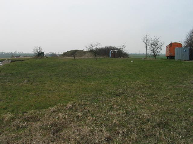
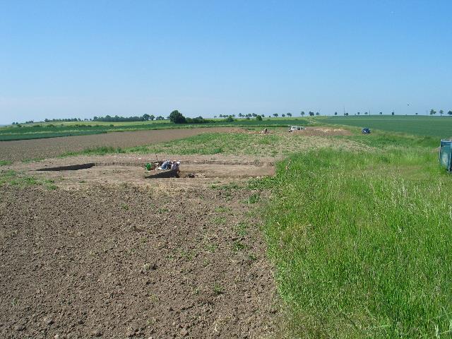
| Abb. 01: Blick von
Westen auf
das Grabungsgelände, rechts ein Zelt. View from west to the excavation area, near by the tent (right) Original date/time: 2008:02:23 17:06:35 (FB) |
 |
| Abb. 02: links die
Zuckerfabrik
von Schladen, im Vordergrund sind einige Mauern
freigelegt. On the left the sugar factory of Schladen, in the foreground some walls are uncovered. Original date/time: 2007:09:09 15:15:40 (FB) |
 |
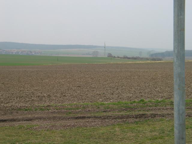
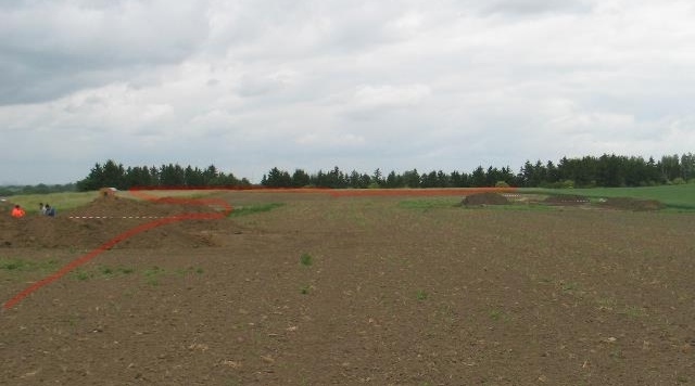
| Abb. 03: Hier hat
es
bereits in früheren Jahren Ausgrabungen
gegeben. Im Hintergrund
das Tal der Oker, Blick nach Süden Here were excavations in earlier years already. In the background the valley of the Oker, view to the south (FB) |
 |
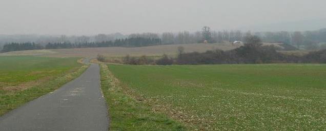
| Abb. 04: Blick nach
Nordwesten
in Richtung einer spürbaren Linie View northwest in the direction of a perceiveable line Original date/time: 2008:02:23 16:45:59 (FB) |
 |
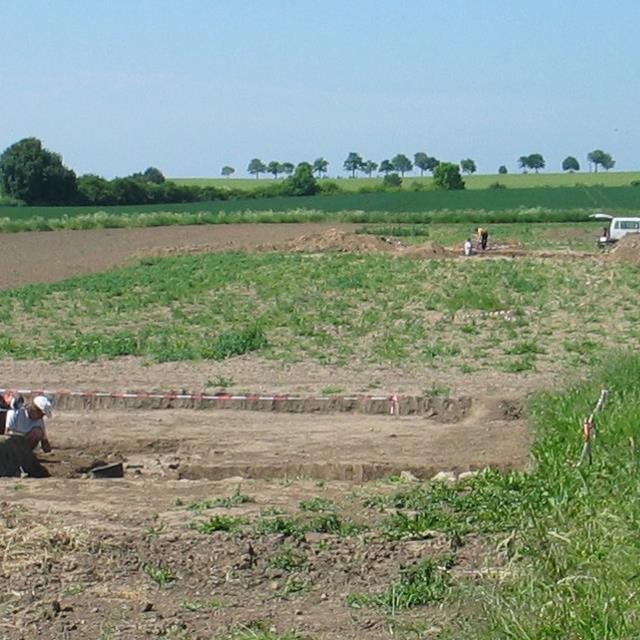
| Abb. 05: Im Norden
schließt sich eine Ackerfläche an mit
sichtbaren und
spürbaren Flächen. Quer durch die Bildmitte zieht sich ein schmaler heller Streifen (horizontal) mit Resten von Mauersteinen. Hier läßt sich eine breite spürbare Zone in Blickrichtung der Kamera verfolgen. In the north an area of farm land closes on with visible and perceiveable surfaces. Straight through the picture center there is a narrow bright strip (horizontally) with remainders of masonry units. Here in line of sight of the camera a broad perceiveable zone can be pursued. Original date/time: 2008:02:23 16:45:59 (FB) |
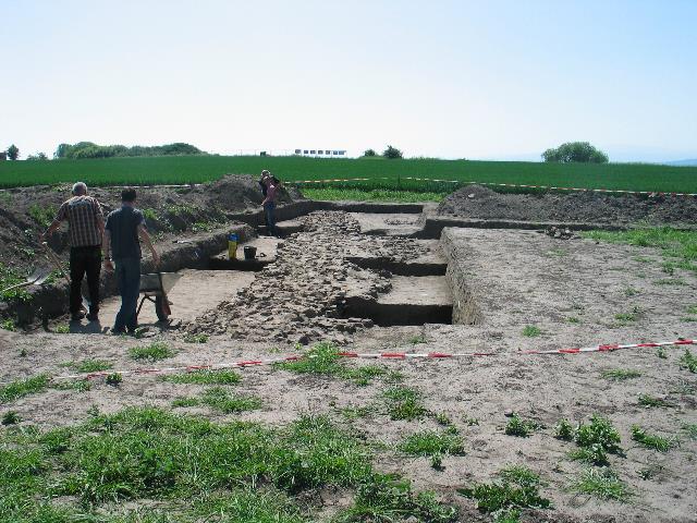 |
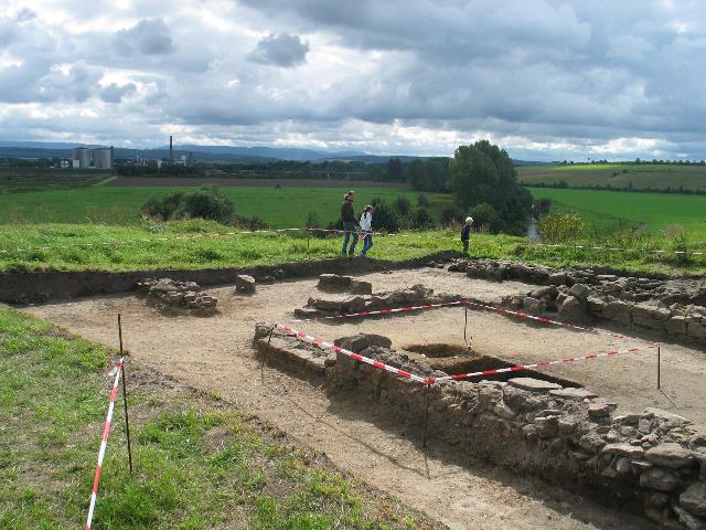
| Abb. 06: Ein Jahr und
drei
Monate später
mit Blick in umgekehrter Richtung. Die Grabung hat
eine alte Ringmauer
freigelegt. One year and three months later viewing into the opposit direction. The excavation opened an old mural. Original date/time: 2009:05:25 11:24:00 (FB) |
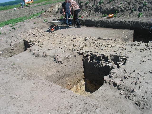 |
| Abb. 07: Die Mauer
besteht aus
vielen kleineren Steinen und hat ein tiefes
Fundament
The wall consists of many smaller stones and has a deep foundation. (FB) |
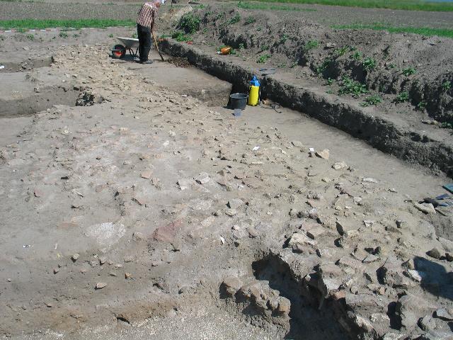 |
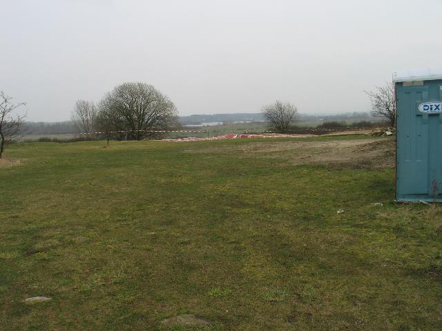
| Abb. 09: die Reste
der Mauer
lagen nur wenige Dezimeter unter der
Ackerfläche.
The remainders of the wall lay only few ten centimeters under the area of the arable land. (FB) |
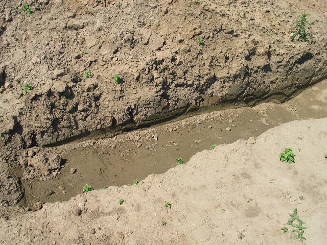 |
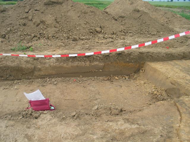
| Abb. 10: Etwas quer
dazu
verlaufen die Reste eines ehemaligen Grabens, sehr
breit.
Somewhat crosswise to it are the remainders of a former ditch, very broad.(FB) |
 |
| Abb. 11: Der Graben
läßt sich als spürbare Zone
verfolgen. Sie
verläuft von der rechten unteren Bildecke
diagonal durch das Bild,
umrundet links die Grabungsfläche im
Vordergrund und geht dann bis zum großen
Erdhaufen in Bildmitte
links
vom weißen Auto und von da weiter bis an den
hinteren Feldrand.
s. Ausschnitt im nächsten Bild The ditch lets itself pursue as a perceiveable zone. It runs by the right lower picture corner diagonally through the picture, turnes round on the left of the excavation surface in the foreground and continues to go then up to the large pile (left from the white car) and from there to the rear edge of field. s. cutout next picture Original date/time: 2009:05:25 11:48:47 (FB) |
 |
| Abb. 12: Ausschnitt
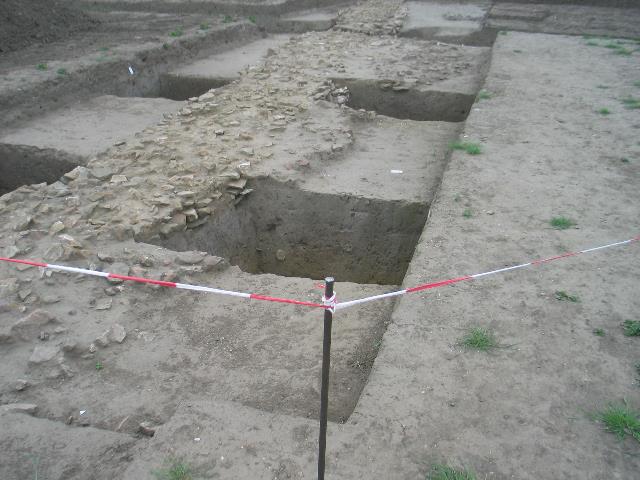
von Abb. 11: Der Graben verläuft von der linken Bildmitte diagonal bis zum Erdhaufen in Bildmitte und von dort weiter bis zum Feldrand (hinter den beiden Personen). Der Grabenschnitt befindet sich vor dem Erdhaufen. The ditch continues to run from the left picture center diagonally up to the large pile in the center and from there up to the edge of the field (behind the two persons). The section of the ditch is just before the pile. (FB) |
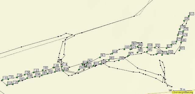 |
| Abb. 13: Die Grenzen
der
gespürten Zone, der Grabenschnitt ist etwa bei
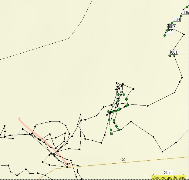
Punkt 061. Zunächst wurde bei Punkt 061 begonnen und der nördliche Rand dokumentiert. Ab Punkt 077 (im hohen Gras) wurde die südliche Kante verfolgt bis Punkt 102. Weiter ging es mit der nördlichen Kante von Punkt 103 bis 110. Die schwarzen Linien und Punkte markieren den gelaufenen Weg, die grünen Punkt sind die gesetzten Markierungen. The borders of the perceived zone, the section of the ditch is approximately at point 061. Pursuing of the object was started at point 061 at the northern edge. From point 077 (in the high grass) the southern edge was pursued until point 102 (following the numbers). It continued to go with the northern edge from point 103 to 110. The black lines and points mark the walked path, the green point are the marked positions. (FB) |
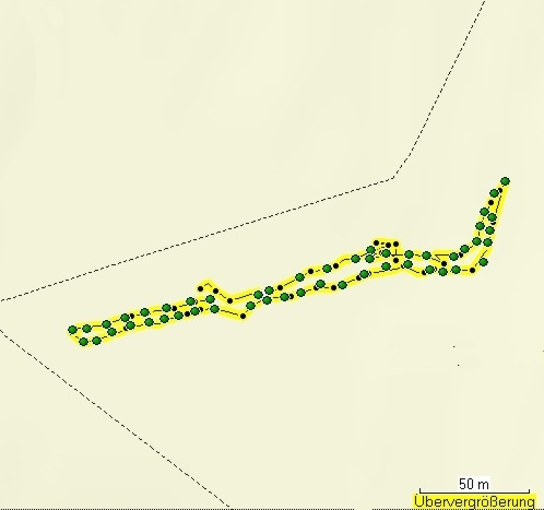 |
| Abb. 14: Die
Ränder des
Grabens, im Bereich der Lücke links ist der
große Erdhaufen
bei Punkt 110. Rechts etwa bei den Punkten 066 war es schwieriger, die Kante des Grabens zu verfolgen. Es gelang aber, in mehreren Versuchen die Fortsetzung zu finden. The edges of the ditch, within the range of the gap left is the large pile at point 110. Right approximately at the points 066 it was more difficult to pursue the edge of the ditch. However it was possible to find the continuation in several attempts. (FB) |
| Liste
der
markierten
Punkte
Gesamt Dauer: elf Minuten, Informationen zu den GPS-Daten: geologie-001 elapsed time: eleven minutes markierte Positionen der Randspuren des Grabens marked positions, edge of the ditch Name, Datum Uhrzeit, Koordinate Geländehöhe/Luftdruck ( unkalibriert) 060 25-MAI-09 11:43:18 N52 02 21.1 E10 33 03.9 519 m 061 25-MAI-09 11:43:22 N52 02 21.1 E10 33 03.9 519 m 062 25-MAI-09 11:43:34 N52 02 21.2 E10 33 04.1 516 m 063 25-MAI-09 11:43:45 N52 02 21.4 E10 33 04.9 517 m 064 25-MAI-09 11:43:54 N52 02 21.5 E10 33 05.5 517 m 065 25-MAI-09 11:44:04 N52 02 21.7 E10 33 06.2 517 m 066 25-MAI-09 11:44:13 N52 02 21.8 E10 33 06.6 517 m 067 25-MAI-09 11:45:29 N52 02 21.7 E10 33 06.5 516 m 068 25-MAI-09 11:45:45 N52 02 21.7 E10 33 06.9 517 m 069 25-MAI-09 11:46:00 N52 02 21.7 E10 33 07.5 518 m 070 25-MAI-09 11:46:15 N52 02 21.7 E10 33 07.9 518 m 071 25-MAI-09 11:46:53 N52 02 21.7 E10 33 08.6 518 m 072 25-MAI-09 11:47:02 N52 02 21.8 E10 33 08.8 519 m 073 25-MAI-09 11:47:11 N52 02 21.9 E10 33 09.1 519 m 074 25-MAI-09 11:47:21 N52 02 22.1 E10 33 09.2 519 m 075 25-MAI-09 11:47:31 N52 02 22.4 E10 33 09.3 519 m 076 25-MAI-09 11:47:46 N52 02 22.6 E10 33 09.5 519 m 077 25-MAI-09 11:47:58 N52 02 22.8 E10 33 09.8 519 m 078 25-MAI-09 11:48:32 N52 02 22.3 E10 33 09.5 518 m 079 25-MAI-09 11:48:39 N52 02 22.1 E10 33 09.4 519 m 080 25-MAI-09 11:48:46 N52 02 21.9 E10 33 09.4 518 m 081 25-MAI-09 11:48:57 N52 02 21.6 E10 33 09.3 519 m 082 25-MAI-09 11:49:15 N52 02 21.5 E10 33 08.6 519 m 083 25-MAI-09 11:49:22 N52 02 21.5 E10 33 08.3 520 m 084 25-MAI-09 11:49:34 N52 02 21.5 E10 33 08.0 519 m 085 25-MAI-09 11:49:50 N52 02 21.6 E10 33 07.5 519 m 086 25-MAI-09 11:50:01 N52 02 21.5 E10 33 06.9 518 m 087 25-MAI-09 11:50:13 N52 02 21.4 E10 33 06.4 517 m 088 25-MAI-09 11:50:24 N52 02 21.3 E10 33 05.9 519 m 089 25-MAI-09 11:50:35 N52 02 21.3 E10 33 05.3 519 m 090 25-MAI-09 11:50:46 N52 02 21.2 E10 33 04.9 519 m 091 25-MAI-09 11:50:55 N52 02 21.1 E10 33 04.5 519 m 092 25-MAI-09 11:51:04 N52 02 21.1 E10 33 04.1 520 m 093 25-MAI-09 11:51:27 N52 02 21.0 E10 33 03.7 518 m 094 25-MAI-09 11:51:48 N52 02 20.9 E10 33 02.8 519 m 095 25-MAI-09 11:51:57 N52 02 20.9 E10 33 02.3 518 m 096 25-MAI-09 11:52:08 N52 02 20.8 E10 33 01.9 520 m 097 25-MAI-09 11:52:16 N52 02 20.8 E10 33 01.6 518 m 098 25-MAI-09 11:52:24 N52 02 20.7 E10 33 01.2 518 m 099 25-MAI-09 11:52:35 N52 02 20.7 E10 33 00.8 519 m 100 25-MAI-09 11:52:44 N52 02 20.6 E10 33 00.3 519 m 101 25-MAI-09 11:52:52 N52 02 20.5 E10 33 00.0 519 m 102 25-MAI-09 11:52:59 N52 02 20.4 E10 32 59.7 519 m 103 25-MAI-09 11:53:20 N52 02 20.6 E10 32 59.4 521 m 104 25-MAI-09 11:53:30 N52 02 20.6 E10 32 59.7 519 m 105 25-MAI-09 11:53:39 N52 02 20.7 E10 33 00.2 519 m 106 25-MAI-09 11:53:50 N52 02 20.8 E10 33 00.6 519 m 107 25-MAI-09 11:54:00 N52 02 20.9 E10 33 01.1 519 m 108 25-MAI-09 11:54:12 N52 02 20.9 E10 33 01.6 519 m 109 25-MAI-09 11:54:28 N52 02 21.0 E10 33 02.2 519 m 110 25-MAI-09 11:54:40 N52 02 21.1 E10 33 02.7 518 m |
| Tabelle 01: die
GPS-Daten der
Randkurve (FB) |
| 5
25.05.2009
11:43:14 518 m 1
m
0:00:14 0.3 km/h
162 N52 02
21.2 E10 33 03.8 6 25.05.2009 11:43:28 519 m 2 m 0:00:03 3 km/h 81 N52 02 21.1 E10 33 03.9 7 25.05.2009 11:43:31 519 m 8 m 0:00:06 5 km/h 69 N52 02 21.1 E10 33 04.0 8 25.05.2009 11:43:37 520 m 16 m 0:00:13 4 km/h 61 N52 02 21.2 E10 33 04.4 9 25.05.2009 11:43:50 519 m 6 m 0:00:03 7 km/h 86 N52 02 21.5 E10 33 05.1 10 25.05.2009 11:43:53 519 m 5 m 0:00:04 5 km/h 70 N52 02 21.5 E10 33 05.4 11 25.05.2009 11:43:57 519 m 5 m 0:00:04 5 km/h 53 N52 02 21.6 E10 33 05.7 12 25.05.2009 11:44:01 519 m 5 m 0:00:04 5 km/h 82 N52 02 21.7 E10 33 05.9 13 25.05.2009 11:44:05 517 m 2 m 0:00:02 4 km/h 73 N52 02 21.7 E10 33 06.2 14 25.05.2009 11:44:07 519 m 14 m 0:00:12 4 km/h 68 N52 02 21.7 E10 33 06.3 15 25.05.2009 11:44:19 519 m 3 m 0:00:12 0.9 km/h 87 N52 02 21.9 E10 33 07.0 16 25.05.2009 11:44:31 518 m 9 m 0:00:12 3 km/h 274 N52 02 21.9 E10 33 07.1 17 25.05.2009 11:44:43 518 m 9 m 0:00:14 2 km/h 91 N52 02 21.9 E10 33 06.7 18 25.05.2009 11:44:57 518 m 7 m 0:00:16 2 km/h 183 N52 02 21.9 E10 33 07.2 19 25.05.2009 11:45:13 519 m 2 m 0:00:02 4 km/h 338 N52 02 21.7 E10 33 07.1 20 25.05.2009 11:45:15 518 m 6 m 0:00:06 4 km/h 284 N52 02 21.7 E10 33 07.1 21 25.05.2009 11:45:21 519 m 4 m 0:00:04 4 km/h 254 N52 02 21.8 E10 33 06.8 22 25.05.2009 11:45:25 519 m 2 m 0:00:05 2 km/h 175 N52 02 21.7 E10 33 06.6 23 25.05.2009 11:45:30 517 m 1 m 0:00:02 3 km/h 55 N52 02 21.7 E10 33 06.6 24 25.05.2009 11:45:32 519 m 6 m 0:00:14 2 km/h 80 N52 02 21.7 E10 33 06.7 25 25.05.2009 11:45:46 519 m 9 m 0:00:13 2 km/h 90 N52 02 21.7 E10 33 07.0 26 25.05.2009 11:45:59 519 m 8 m 0:00:13 2 km/h 92 N52 02 21.7 E10 33 07.5 27 25.05.2009 11:46:12 519 m 9 m 0:00:15 2 km/h 114 N52 02 21.7 E10 33 07.9 28 25.05.2009 11:46:27 519 m 6 m 0:00:15 1.4 km/h 313 N52 02 21.6 E10 33 08.3 29 25.05.2009 11:46:42 519 m 11 m 0:00:15 3 km/h 89 N52 02 21.7 E10 33 08.1 30 25.05.2009 11:46:57 520 m 10 m 0:00:13 3 km/h 54 N52 02 21.7 E10 33 08.7 31 25.05.2009 11:47:10 519 m 9 m 0:00:14 2 km/h 13 N52 02 21.9 E10 33 09.1 32 25.05.2009 11:47:24 520 m 11 m 0:00:15 3 km/h 24 N52 02 22.2 E10 33 09.2 33 25.05.2009 11:47:39 520 m 7 m 0:00:11 2 km/h 38 N52 02 22.5 E10 33 09.4 34 25.05.2009 11:47:50 520 m 4 m 0:00:12 1.3 km/h 38 N52 02 22.7 E10 33 09.7 35 25.05.2009 11:48:02 520 m 1 m 0:00:03 0.8 km/h 247 N52 02 22.8 E10 33 09.8 36 25.05.2009 11:48:05 520 m 7 m 0:00:16 2 km/h 196 N52 02 22.8 E10 33 09.8 37 25.05.2009 11:48:21 520 m 11 m 0:00:13 3 km/h 197 N52 02 22.5 E10 33 09.7 38 25.05.2009 11:48:34 520 m 5 m 0:00:06 3 km/h 196 N52 02 22.2 E10 33 09.5 39 25.05.2009 11:48:40 519 m 1 m 0:00:02 1.4 km/h 161 N52 02 22.1 E10 33 09.4 40 25.05.2009 11:48:42 520 m 5 m 0:00:05 4 km/h 194 N52 02 22.0 E10 33 09.4 41 25.05.2009 11:48:47 518 m 1 m 0:00:02 2 km/h 186 N52 02 21.9 E10 33 09.4 42 25.05.2009 11:48:49 520 m 12 m 0:00:15 3 km/h 214 N52 02 21.8 E10 33 09.3 43 25.05.2009 11:49:04 520 m 9 m 0:00:13 2 km/h 269 N52 02 21.5 E10 33 09.0 44 25.05.2009 11:49:17 520 m 1 m 0:00:01 3 km/h 278 N52 02 21.5 E10 33 08.5 45 25.05.2009 11:49:18 520 m 8 m 0:00:13 2 km/h 272 N52 02 21.5 E10 33 08.5 46 25.05.2009 11:49:31 520 m 5 m 0:00:07 2 km/h 253 N52 02 21.5 E10 33 08.1 47 25.05.2009 11:49:38 520 m 3 m 0:00:03 3 km/h 269 N52 02 21.5 E10 33 07.8 48 25.05.2009 11:49:41 520 m 7 m 0:00:13 2 km/h 294 N52 02 21.5 E10 33 07.7 49 25.05.2009 11:49:54 520 m 4 m 0:00:03 4 km/h 245 N52 02 21.6 E10 33 07.3 50 25.05.2009 11:49:57 520 m 13 m 0:00:14 3 km/h 261 N52 02 21.5 E10 33 07.1 51 25.05.2009 11:50:11 518 m 3 m 0:00:04 3 km/h 236 N52 02 21.5 E10 33 06.5 52 25.05.2009 11:50:15 520 m 2 m 0:00:02 4 km/h 251 N52 02 21.4 E10 33 06.4 53 25.05.2009 11:50:17 520 m 12 m 0:00:12 4 km/h 250 N52 02 21.4 E10 33 06.2 54 25.05.2009 11:50:29 520 m 8 m 0:00:09 3 km/h 268 N52 02 21.2 E10 33 05.6 55 25.05.2009 11:50:38 520 m 12 m 0:00:14 3 km/h 250 N52 02 21.2 E10 33 05.2 56 25.05.2009 11:50:52 520 m 10 m 0:00:16 2 km/h 269 N52 02 21.1 E10 33 04.6 57 25.05.2009 11:51:08 520 m 8 m 0:00:18 2 km/h 242 N52 02 21.1 E10 33 04.1 58 25.05.2009 11:51:26 521 m 1 m 0:00:02 2 km/h 234 N52 02 21.0 E10 33 03.7 59 25.05.2009 11:51:28 519 m 0 m 0:00:02 0.5 km/h 197 N52 02 21.0 E10 33 03.7 60 25.05.2009 11:51:30 521 m 6 m 0:00:06 3 km/h 223 N52 02 21.0 E10 33 03.7 61 25.05.2009 11:51:36 521 m 13 m 0:00:12 4 km/h 284 N52 02 20.8 E10 33 03.5 62 25.05.2009 11:51:48 519 m 7 m 0:00:08 3 km/h 267 N52 02 20.9 E10 33 02.8 63 25.05.2009 11:51:56 521 m 3 m 0:00:02 5 km/h 240 N52 02 20.9 E10 33 02.4 64 25.05.2009 11:51:58 518 m 1 m 0:00:02 2 km/h 269 N52 02 20.9 E10 33 02.3 65 25.05.2009 11:52:00 521 m 3 m 0:00:03 3 km/h 256 N52 02 20.9 E10 33 02.3 66 25.05.2009 11:52:03 521 m 11 m 0:00:13 3 km/h 255 N52 02 20.8 E10 33 02.1 67 25.05.2009 11:52:16 517 m 1 m 0:00:01 3 km/h 242 N52 02 20.8 E10 33 01.6 68 25.05.2009 11:52:17 519 m 2 m 0:00:02 3 km/h 237 N52 02 20.7 E10 33 01.5 69 25.05.2009 11:52:19 521 m 5 m 0:00:06 3 km/h 270 N52 02 20.7 E10 33 01.5 70 25.05.2009 11:52:25 518 m 1 m 0:00:01 4 km/h 261 N52 02 20.7 E10 33 01.2 71 25.05.2009 11:52:26 521 m 1 m 0:00:01 5 km/h 253 N52 02 20.7 E10 33 01.1 72 25.05.2009 11:52:27 521 m 8 m 0:00:10 3 km/h 257 N52 02 20.7 E10 33 01.1 73 25.05.2009 11:52:37 521 m 3 m 0:00:04 3 km/h 239 N52 02 20.6 E10 33 00.7 74 25.05.2009 11:52:41 521 m 4 m 0:00:04 4 km/h 259 N52 02 20.6 E10 33 00.5 75 25.05.2009 11:52:45 520 m 1 m 0:00:02 2 km/h 218 N52 02 20.6 E10 33 00.3 76 25.05.2009 11:52:47 521 m 12 m 0:00:13 3 km/h 253 N52 02 20.5 E10 33 00.2 77 25.05.2009 11:53:00 520 m 1 m 0:00:02 3 km/h 324 N52 02 20.4 E10 32 59.6 78 25.05.2009 11:53:02 521 m 6 m 0:00:14 2 km/h 313 N52 02 20.5 E10 32 59.6 79 25.05.2009 11:53:16 521 m 4 m 0:00:09 1.5 km/h 58 N52 02 20.6 E10 32 59.3 80 25.05.2009 11:53:25 521 m 14 m 0:00:15 3 km/h 85 N52 02 20.7 E10 32 59.5 81 25.05.2009 11:53:40 519 m 2 m 0:00:02 3 km/h 45 N52 02 20.7 E10 33 00.2 82 25.05.2009 11:53:42 521 m 10 m 0:00:10 4 km/h 73 N52 02 20.7 E10 33 00.3 83 25.05.2009 11:53:52 521 m 8 m 0:00:09 3 km/h 78 N52 02 20.8 E10 33 00.8 84 25.05.2009 11:54:01 519 m 1 m 0:00:02 2 km/h 71 N52 02 20.9 E10 33 01.2 85 25.05.2009 11:54:03 521 m 11 m 0:00:12 3 km/h 81 N52 02 20.9 E10 33 01.2 86 25.05.2009 11:54:15 521 m 10 m 0:00:14 3 km/h 72 N52 02 20.9 E10 33 01.8 87 25.05.2009 11:54:29 519 m 1 m 0:00:02 2 km/h 81 N52 02 21.0 E10 33 02.3 88 25.05.2009 11:54:31 521 m 6 m 0:00:09 2 km/h 83 N52 02 21.0 E10 33 02.4 89 25.05.2009 11:54:40 518 m 1 m 0:00:01 2 km/h 46 N52 02 21.1 E10 33 02.7 |
| Tabelle 02: Track,
Protokoll des
gegangenen Weges. Die Spalte mit der Geschwindigkeit
zeigt ein
mittleres Tempo von etwa 2,5 km/h an.
Synchronisierung zu Tabelle 01
ist
über die Uhrzeit möglich.
Minutes of the gone way. The column with the speed indicates a middle speed of approximately 2.5 km/h. Synchronization to table 01 is possible over the time. (FB) |
Weitere Experimente am 04.06.2009 further experiments
 |
| Abb. 15: Der Graben
aus Abb. 10
wurde weiter freigelegt. The ditch in fig. 10 has been excavated more. (FB) |
 |
| Abb. 16: Der gemutete
Graben
verläuft links am Bildrand bis zur Wiese mit
dem hohen Gras, vor
dem Wald entlang nach rechts (rosa Linie) The ditch runs left at the contour up to the meadow with the high grass, before the forest along to the right (pink line) (FB) |
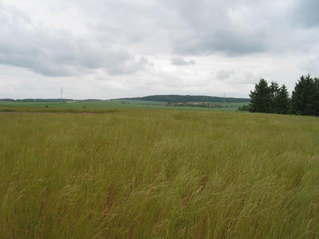 |
| Abb. 17: Panormabild
1, der
Graben kommt von links hinten, seine Spur
läßt sich hier im
mehr als kniehohen Gras verfolgen, Standort
Punkt 023, Panorma part 1, the ditch comes from the left behind, its trace can be pursued in the more than kneel-high grass , location point 023, Original date/time: 2009:06:04 11:05:35 (FB) |
 |
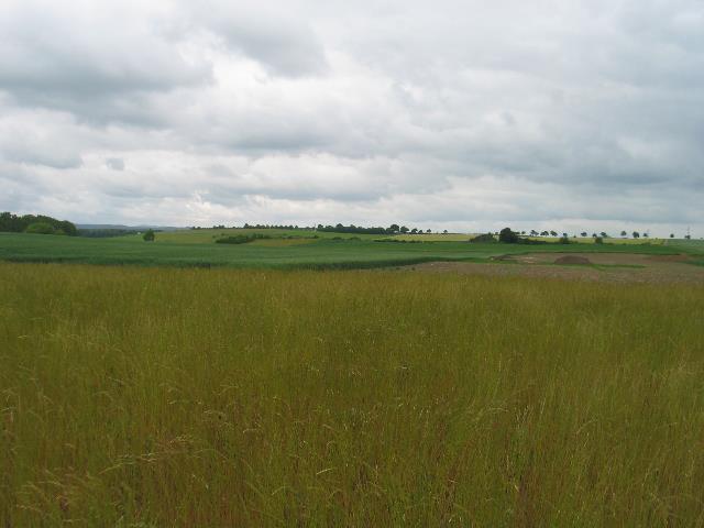
| Abb. 18:Panoramabild
2, Blick
zurück zur Grabungsfläche, in diesem
Bereich geht die Spur
des Grabens im hohen Gras quer zum Bild, Panorama part 2, view back to the excavation surface, within this range the trace of the ditch in the high grass crosses the picture, Original date/time: 2009:06:04 11:05:38 (FB) |
 |
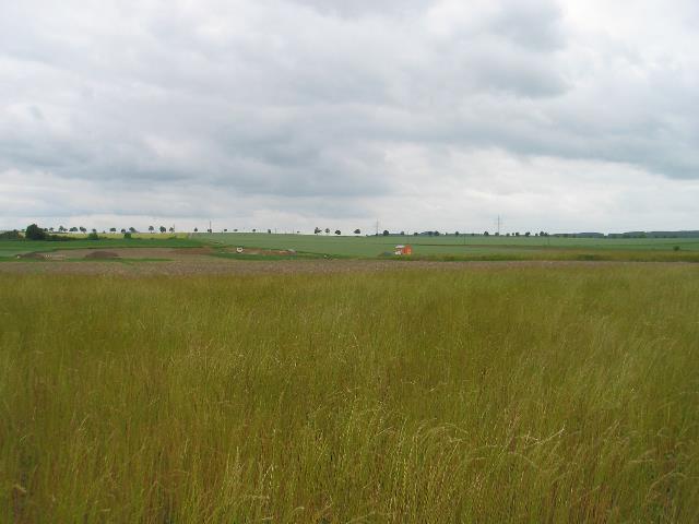
| Abb. 19: Panoramabild
3,
Etwa dort, wo sich am linken Bildrand das Gras und
das dunkle Getreide
treffen endet der abgesuchte Bereich und damit auch
die gefundene Spur. Panorama part 3, at the left contour where of the grass and the dark grain meet the searched range ends and with it the found trace. Original date/time: 2009:06:04 11:05:43 (FB) |
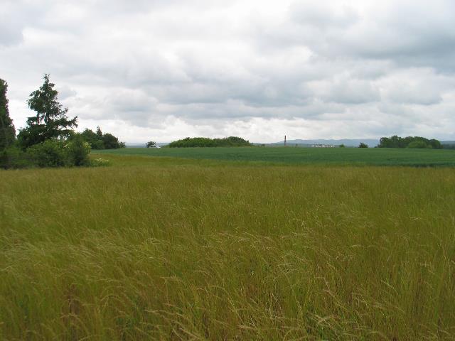 |
| Abb. 20: Panoramabild
4, Bei
dieser kleinen Bodensenke links weicht die Spur nach
rechts aus. Im
Hintergrund der Schornstein der Zuckerfabrik
Schladen. Panorama part 4, with this small ground depression (left) the trace goes to the right. In the background the chimney of the sugar factory Schladen. Original date/time: 2009:06:04 11:05:48 (FB) |
 |
| Abb. 21: Die Spur des
Grabens
und zwar die Außenkante geht von den Punkten
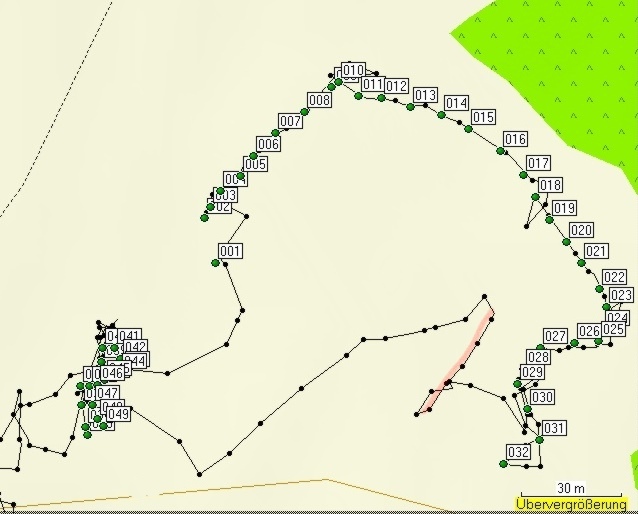
002 bis 032, die Punkte 033 bis 049 ergibt den gemuteten Verlauf der Mauer nach Nordwesten. Länge 240 Meter. Bei den Punkten 010, 018, 024, 029 und 31 jeweils zeigen die Zacken der schwarzen Spur, daß die Suche hier etwas schwieriger war. Parallel zu der Linie aus den Punkten 027 bis 029 etwas weiter nordwestlich gibt es eine lineare Struktur etwa 30 Meter lang (rosa Linie, schwarze Spur) The trace of the ditch (the outside edge) goes from the points 002 to 032, the points 033 to 049 results in the continuation of the wall after northwest. Length of 240 meters. At the points 010, 018, 024, 029 and 31 the zigzag of the black trace shows that the search was here somewhat more difficult. Parallel to the line from the points 027 to 029 a little bit northwest there is given a linear structure about 30 meters long (pink line, black trace) (FB) |
 |
| Abb. 21a:
Übersicht,
Zusammenfügung der Daten vom 25.05. 2009 (blau)
und vom 04.06.
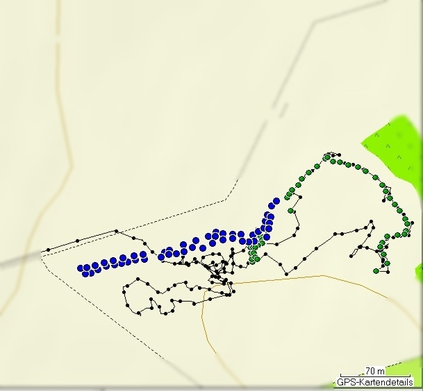
2009 (grün) Das Gras in Abb. 11 ist in der Zwischenzeit stark gewachsen. Die schwarze Spur zeigt den gegangenen Weg. An einigen Stellen wurden spürbare Kanten gefunden und dann bogenförmig abgesucht und verfolgt. Aus dem Parallelversatz des Tracks auf dem Feldwege ergibt sich eine Koordinatenverschiebung der GPS-Daten zur Karte von 4 Metern nach Norden. Im Bereich des Waldes rechts scheint der Verlauf der Spur einer Höhenlinie bzw. der Geländekante zu folgen. Overview, joining the data from 25.05.2009 (blue) and from 04.06.2009 (green) The grass in fig. 11 grew in the meantime strongly. The black trace shows the gone way. In some places some edges could be perceived and pursued arc-shaped. From the parallel disalignment of the track to that farm way a coordinate shift of the GPS data to the map of 4 meters northward results. In the range of the forest right the continuation of the trace seems to follow a contour line. (FB) |
 |
| Abb. 22: Der
Eisenpfahl
ist Punkt 033, von hier nach rückwärts
wurde der Verlauf der
Mauer gesucht. (Richtung wie in Abb. 09 nach links oben) The iron stake is point 033, from here going backwards the continuation of the wall was searched. (Direction as in fig. 09 to the left) Original date/time: 2009:06:04 11:15:54 (FB) |
 |
| Abb. 23: Der gemutete
Verlauf
der Mauer (grüne Punkte, 033 bis 049). Es sind
beide Randlinien
aufgenommen worden. Links unten im Bild zeigen die Track-Punkte, dass es die Kante eines spürbaren Objekts gibt, daß die linke untere Bildecke etwa mit 45 Grad schneidet (rosa Linie). The continuation of the wall (green points, to 033 to 049). Both edge lines were taken up. On the left lower corner of the picture some points of the track show that there is an edge of a noticeable object with approximately 45 degrees (pink line) to the contour. (FB) |
| Spur des Graben und Fortsetzung der Mauer trace of the ditch and continuation of the wall Gesamt Dauer: acht Minuten, Informationen zu den GPS-Daten: geologie-001 elapsed time: eight minutes markierte Positionen der äußeren Randspuren des Grabens edges of the ditch Name, Datum Uhrzeit, Koordinate Geländehöhe/Luftdruck height / airpressure 001 04-JUN-09 10:57:56 N52 02 22.5 E10 33 10.6 124 m Graben ditch 002 04-JUN-09 10:59:47 N52 02 22.9 E10 33 10.4 123 m 003 04-JUN-09 10:59:54 N52 02 23.0 E10 33 10.5 124 m 004 04-JUN-09 11:00:05 N52 02 23.2 E10 33 10.6 125 m 005 04-JUN-09 11:00:14 N52 02 23.3 E10 33 11.0 125 m 006 04-JUN-09 11:00:22 N52 02 23.5 E10 33 11.2 125 m 007 04-JUN-09 11:00:33 N52 02 23.7 E10 33 11.5 124 m 008 04-JUN-09 11:00:42 N52 02 23.9 E10 33 12.0 124 m 009 04-JUN-09 11:00:52 N52 02 24.2 E10 33 12.4 124 m 010 04-JUN-09 11:01:45 N52 02 24.2 E10 33 12.5 124 m 011 04-JUN-09 11:01:55 N52 02 24.1 E10 33 12.8 124 m 012 04-JUN-09 11:02:01 N52 02 24.1 E10 33 13.2 123 m 013 04-JUN-09 11:02:10 N52 02 24.0 E10 33 13.6 123 m 014 04-JUN-09 11:02:22 N52 02 23.9 E10 33 14.1 124 m 015 04-JUN-09 11:02:32 N52 02 23.8 E10 33 14.5 124 m 016 04-JUN-09 11:02:43 N52 02 23.6 E10 33 15.1 123 m 017 04-JUN-09 11:02:55 N52 02 23.3 E10 33 15.4 124 m 018 04-JUN-09 11:03:46 N52 02 23.1 E10 33 15.6 123 m 019 04-JUN-09 11:03:55 N52 02 22.9 E10 33 15.8 122 m 020 04-JUN-09 11:04:04 N52 02 22.7 E10 33 16.1 122 m 021 04-JUN-09 11:04:13 N52 02 22.5 E10 33 16.3 123 m 022 04-JUN-09 11:04:22 N52 02 22.2 E10 33 16.6 123 m 023 04-JUN-09 11:04:27 N52 02 22.1 E10 33 16.7 123 m 024 04-JUN-09 11:05:41 N52 02 21.8 E10 33 16.7 122 m 025 04-JUN-09 11:05:57 N52 02 21.7 E10 33 16.6 122 m 026 04-JUN-09 11:06:20 N52 02 21.7 E10 33 16.2 122 m 027 04-JUN-09 11:06:34 N52 02 21.7 E10 33 15.7 120 m 028 04-JUN-09 11:06:47 N52 02 21.5 E10 33 15.4 121 m 029 04-JUN-09 11:07:00 N52 02 21.3 E10 33 15.3 121 m 030 04-JUN-09 11:07:13 N52 02 21.1 E10 33 15.5 121 m 031 04-JUN-09 11:07:24 N52 02 20.8 E10 33 15.7 121 m 032 04-JUN-09 11:07:52 N52 02 20.5 E10 33 15.1 121 m Mauer wall 033 04-JUN-09 11:14:53 N52 02 20.8 E10 33 08.5 115 m 034 04-JUN-09 11:15:43 N52 02 20.9 E10 33 08.5 114 m 035 04-JUN-09 11:15:52 N52 02 21.1 E10 33 08.5 113 m 036 04-JUN-09 11:16:21 N52 02 21.3 E10 33 08.4 114 m 037 04-JUN-09 11:16:36 N52 02 21.3 E10 33 08.6 114 m 038 04-JUN-09 11:16:48 N52 02 21.3 E10 33 08.8 114 m 039 04-JUN-09 11:17:01 N52 02 21.5 E10 33 08.8 114 m 040 04-JUN-09 11:17:12 N52 02 21.7 E10 33 08.8 114 m 041 04-JUN-09 11:17:57 N52 02 21.7 E10 33 09.0 114 m 042 04-JUN-09 11:18:06 N52 02 21.5 E10 33 09.1 114 m 043 04-JUN-09 11:18:16 N52 02 21.4 E10 33 09.1 113 m 044 04-JUN-09 11:18:26 N52 02 21.4 E10 33 09.1 113 m 045 04-JUN-09 11:18:35 N52 02 21.3 E10 33 08.8 113 m 046 04-JUN-09 11:18:44 N52 02 21.3 E10 33 08.7 114 m 047 04-JUN-09 11:18:56 N52 02 21.1 E10 33 08.6 114 m 048 04-JUN-09 11:19:05 N52 02 21.0 E10 33 08.7 113 m 049 04-JUN-09 11:19:09 N52 02 20.9 E10 33 08.8 113 m |
| Tabelle03: Die
GPS-Daten
vom 4.6.2009 , an diesem Tage wehte ein starker
Wind. Möglicherweise sind deshalb die Höhendaten etwas von der Richtung des Gehens abhängig (GPS-Gerät im Windschatten des Körpers oder dem Wind ausgesetzt.) 4.6.2009, GPS data, on this day a strong wind blew. Therefore the elevation data possibly depend on the direction of going (GPS equipment in the lee of the body or exposed to the wind) |
 |
www.biosensor-physik.de | (c)
26.02.2009 - 17.11.2011 F.Balck |
© BioSensor-Physik 2011
· Impressum